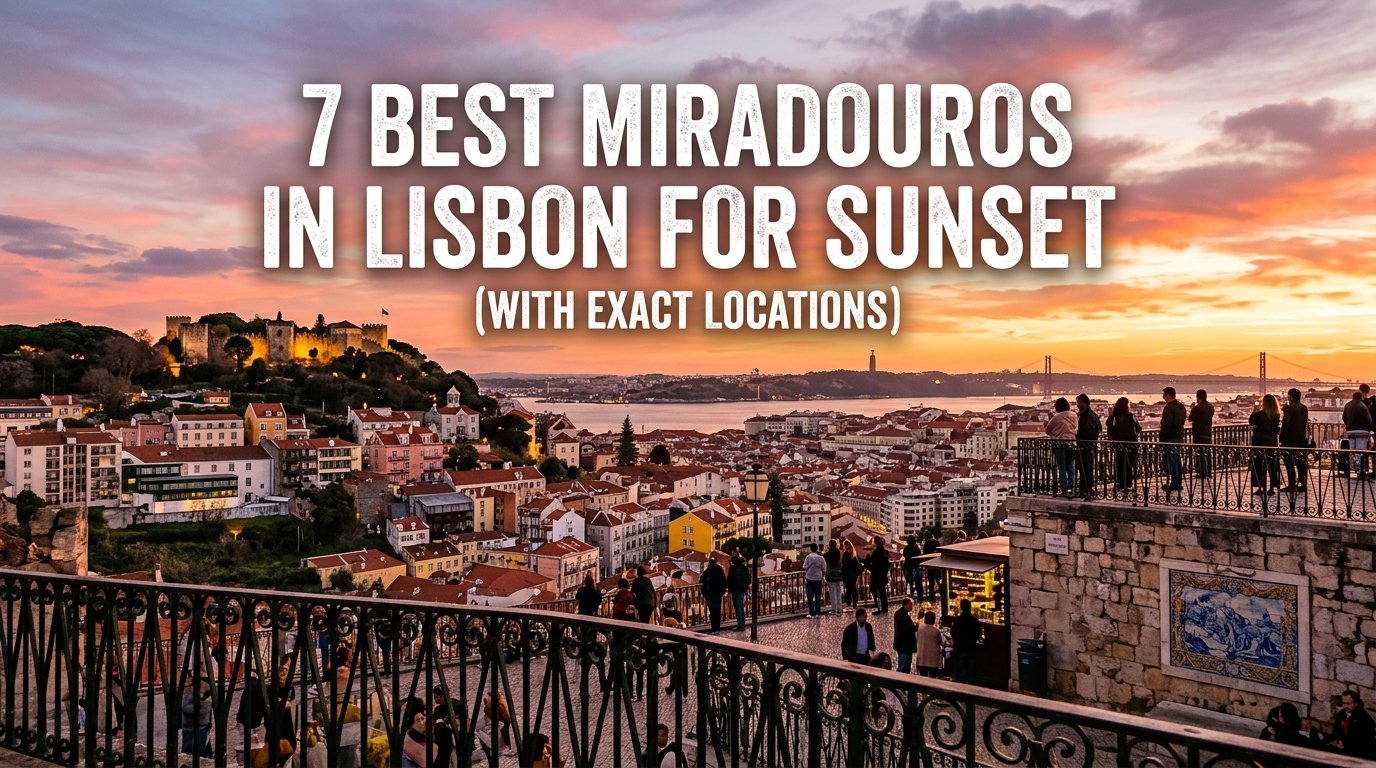
7 Best Miradouros in Lisbon for Sunset (With Exact Locations)
Lisbon features a complex urban landscape spread across steep hills facing the Tagus River estuary. This specific geographic layout makes the city ideal for golden hour photography and sunset viewing. The timing of the sunset changes throughout the year, varying from roughly 17:15 in December to 21:15 in late June.
Finding the highest viewpoint in Lisbon or navigating the narrow alleys of historical neighborhoods requires clear route planning. The local lookout points, known as miradouros, offer distinct angles of the river, historical monuments, and urban neighborhoods. Utilizing public transport options like the historic tram networks helps manage the physical elevation changes.
The following master table provides an operational overview of the primary sunset viewing platforms across the city center.
Best Miradouros in Lisbon
Use this quick guide to compare Lisbon’s most beautiful viewpoints by location, transport, and what each spot is best known for.
| Miradouro Name | Neighborhood / Hill | Primary Transit Option | Best For |
|---|---|---|---|
| Miradouro da Senhora do Monte | Graça / São Vicente | Tram 28 / Walk | Comprehensive 360-degree panoramic views |
| Miradouro de Santa Catarina | Bairro Alto / Misericórdia | Tram 28 / Elevador da Bica | River traffic, bridge views, and social atmosphere |
| Miradouro da Graça | Graça | Tram 28 / Graça Funicular | Direct views of São Jorge Castle and central valleys |
| Miradouro de São Pedro de Alcântara | Príncipe Real / Bairro Alto | Elevador da Glória / Metro | Formally landscaped terrace and lower town views |
| Miradouro de Santa Luzia | Alfama | Tram 28 / Bus 737 | Tiled terrace framing the traditional old town roofscape |
| Miradouro das Portas do Sol | Alfama | Tram 28 / Bus 737 | Unobstructed eastward river morning and evening light |
| Miradouro do Recolhimento | Castelo | Walk from Castle Gates | Quiet, low-congestion viewing near the historical fort |
Miradouro da Senhora do Monte (Graça)
Exact Geographic Coordinates & Street Address
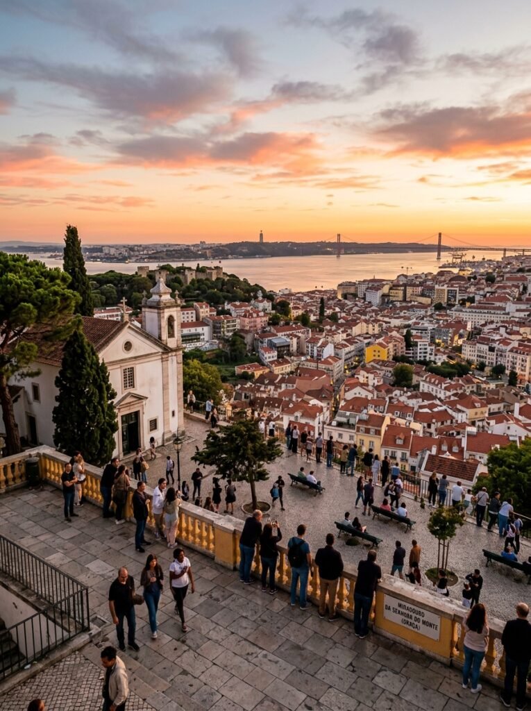
The Miradouro da Senhora do Monte holds the status of the highest viewpoint in Lisbon. The official street address is Largo Monte, 1170-107 Lisboa, Portugal. The exact geographic positioning can be targeted via the coordinates 38.7191° N, 9.1330° W.
Step-by-Step Transit Logistics
Reaching this platform from the lower Baixa district requires navigating a steep vertical incline. Travelers can board the historic Tram 28 and disembark at the Rua da Graça stop. From this point, a 450-meter uphill walk along Calçada do Monte is required, which features uneven, traditional stone paving. Alternatively, the Anjos Metro Station on the Green Line sits a 15-minute uphill walk away from the base of the hill.
Golden Hour Visual Mechanics
Because this terrace is the highest natural elevation in the central municipality, it provides an unobstructed 360-degree panoramic view. At sunset, the camera orientation should face directly west-southwest to capture the sun dipping behind the 25 de Abril Bridge and the Monsanto Forest Park.
The wide angle allows photographers to frame the terracotta roofs of the Mouraria quarter alongside the ancient stone battlements of São Jorge Castle. Lens choices between 24mm and 50mm work best here to balance the distant river horizon with the foreground architecture.
Know-Before-You-Go Infrastructure
The viewpoint is situated inside a quiet historical churchyard adjacent to the Chapel of Our Lady of the Mount. There are no permanent indoor restaurants or public restroom buildings directly on the viewing square. Mobile street vendors and small tuk-tuk drivers occasionally sell bottled water, but visitors should bring independent supplies. Crowding peaks exactly 30 minutes before sunset, meaning arrival at least one hour early is necessary to secure a spot along the stone boundary wall.
Miradouro de Santa Catarina (Adamastor / Bairro Alto)
Exact Geographic Coordinates & Street Address
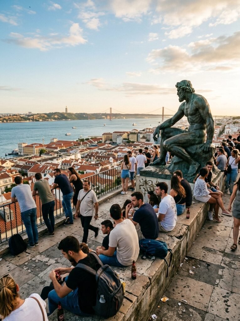
The Miradouro de Santa Catarina is positioned on the southwestern ridge of the Bairro Alto district. The physical address is Rua de Santa Catarina, 1200-401 Lisboa, Portugal. The exact positioning parameters are 38.7102° N, 9.1477° W.
Step-by-Step Transit Logistics
The most straightforward transit option is via the historic Elevador da Bica funicular, which drops passengers off less than 100 meters from the square. Alternatively, visitors can take the Metro to the Baixa-Chiado station (Green/Blue Lines) and execute a flat, 600-meter westward walk down Rua de San Marçal and Calçada do Combro.
The immediate access streets are surfaced with standard calçada portuguesa limestone squares, requiring careful foot placement on the moderate slope.
Golden Hour Visual Mechanics
This platform faces directly south-southwest across the narrowest stretch of the Tagus River. The sunset light frames the structural towers of the 25 de Abril Bridge and the distant Cristo Rei monument on the southern bank.
Photographers should position their gear near the central statue of the mythical sea monster Adamastor to get clear foreground framing. A telephoto lens ranging from 70mm to 200mm is ideal for capturing the silhouette of moving cargo ships and local commuter ferries against the reflective river surface.
Know-Before-You-Go Infrastructure
The terrace features a permanent, open-air café kiosk (esplanada) that serves light snacks and cold refreshments. Public restrooms are not directly integrated into the square, though commercial facilities exist in the adjacent businesses.
The atmosphere is highly social and active, frequently drawing local musicians and student groups during the golden hour. Police presence is routine, but travelers must remain alert to pickpocketing risks as density increases prior to twilight.
Miradouro da Graça (Sophia de Mello Breyner Andresen)
Exact Geographic Coordinates & Street Address
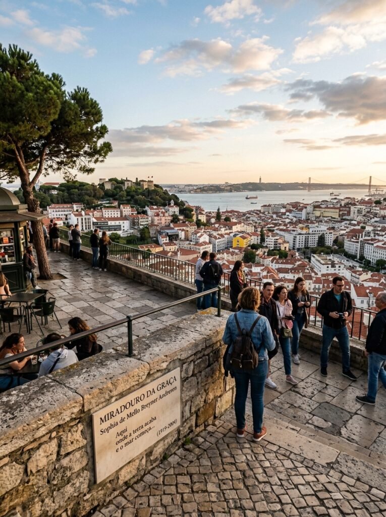
The Miradouro da Graça is formally dedicated to the Portuguese poet Sophia de Mello Breyner Andresen. It occupies a prominent ledge on the eastern side of the central valley at Largo da Graça, 1170-165 Lisboa, Portugal. The geographical coordinate reference for this terrace is 38.7162° N, 9.1315° W.
Step-by-Step Transit Logistics
Passengers using the historic Tram 28 should disembark at the Graça stop, leaving a flat 150-meter walk westward to the pine-shaded square.
The automated Graça Funicular (Elevador da Graça) also connects the lower Mouraria district at Rua dos Lagares directly to the viewpoint hillside, removing the need to climb the steep public staircases. The path leading from the funicular exit to the terrace is flat but consists of traditional stone pavement that can become slippery.
Golden Hour Visual Mechanics
This platform sits directly opposite São Jorge Castle, providing a lateral view of the fortress walls as they reflect the evening light. The view looks southwest across the Baixa grid toward the ruins of the Carmo Convent and the rolling terrain of the Monsanto Forest Park. Camera equipment should be aimed at a wide angle to encompass the lower town valley and the river simultaneously.
The shadow lines cast by the castle walls lengthen rapidly in the final 20 minutes before twilight, creating strong contrast for architectural photography.
Know-Before-You-Go Infrastructure
A permanent open-air refreshment kiosk with table seating sits directly on the terrace under a canopy of pine trees. The open square has no dedicated public restroom buildings, though patrons can utilize the facilities at nearby commercial venues.
The site features a mix of tourists, families, and artists, with the highest visitor volume arriving during mid-summer. Benches line the stone parapet, but these fill up completely approximately 45 minutes before the sun drops below the western horizon.
Miradouro de São Pedro de Alcântara (Príncipe Real)
Exact Geographic Coordinates & Street Address
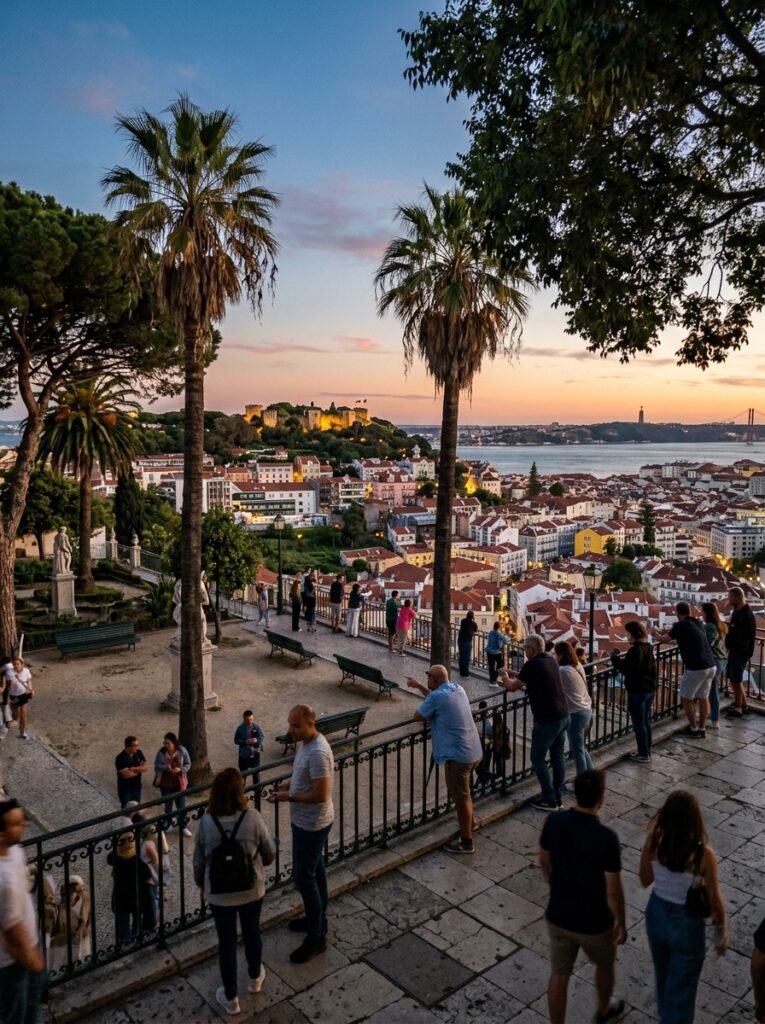
The Miradouro de São Pedro de Alcântara is a split-level landscaped terrace located on the western ridge of the central valley. The official address is Rua de São Pedro de Alcântara, 1200-470 Lisboa, Portugal. The geographic alignment maps precisely to the coordinates 38.7150° N, 9.1444° W.
Step-by-Step Transit Logistics
The most iconic method to reach this viewpoint is via the Elevador da Glória funicular, which climbs directly from Praça dos Restauradores to the edge of the terrace. Alternatively, the Restauradores Metro Station (Blue Line) offers an immediate connection to the base of the funicular hill.
For a pedestrian approach from the Chiado neighborhood, visitors can follow a flat 500-meter walk northward along Rua da Misericórdia, which features wide sidewalks and well-maintained stone pathways.
Golden Hour Visual Mechanics
This platform faces directly east-southeast, meaning the sun sets directly behind the viewer rather than over the water. The primary photographic value here lies in the warm, direct illumination of the opposite hill, which lights up the ancient stone walls of São Jorge Castle and the houses of Alfama.
The panoramic view also captures the lower Baixa district and the wide expanse of the river. To capture the full scope of the illuminated valley, a wide-angle lens such as a 16mm or 24mm is highly recommended.
Know-Before-You-Go Infrastructure
The park features a formal fountain, geometric flowerbeds, and a permanent refreshment kiosk with outdoor seating. Public restrooms are available in the lower garden level for a small maintenance fee.
The upper platform is wide and highly accessible, accommodating large crowds without feeling overly congested. Because it borders the nightlife districts of Bairro Alto and Príncipe Real, security patrols are frequent, and the area remains well-lit long after the twilight period concludes.
Miradouro de Santa Luzia (Alfama)
Exact Geographic Coordinates & Street Address
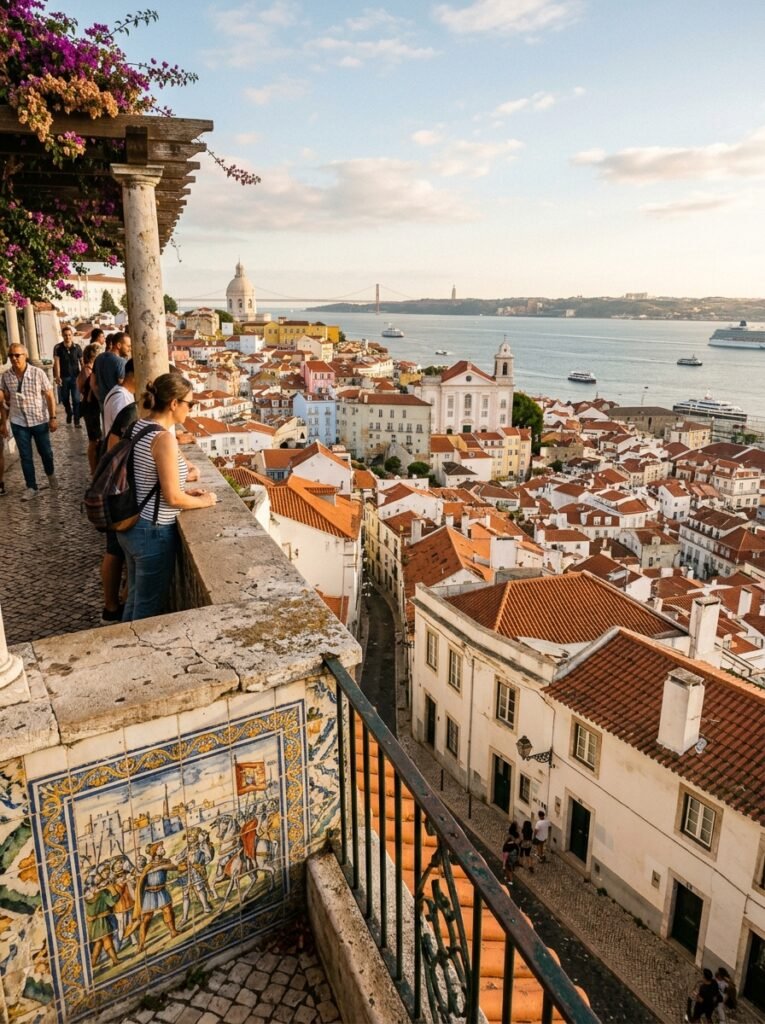
The Miradouro de Santa Luzia is a terraced observation platform located on the southern slope of the Alfama hill. The physical address is Largo de Santa Luzia, 1100-487 Lisboa, Portugal. The geographical coordinates for this site are 38.7116° N, 9.1303° W.
Step-by-Step Transit Logistics
Travelers can access this site directly via the historic Tram 28 or Bus line 737, which stop right outside the entrance gate at the Largo de Santa Luzia station. For those walking from the lower waterfront area near the Terreiro do Paço metro station (Blue Line), the route involves a steep 600-meter climb up the Calçada do Marquês de Tancos.
The pedestrian walkways are composed of traditional, narrow cobblestones that feature multiple short staircases and uneven grading.
Golden Hour Visual Mechanics
This viewpoint faces east-southeast over the ancient layout of the Alfama district and the Tagus River. The sunset light strikes the white dome of the National Pantheon and the towers of the Church of São Vicente de Fora from behind, casting long shadows across the red terracotta roofs.
Photographers can use the iconic blue-and-white glazed tile panels (azulejos) and the overhead flower pergolas as a decorative foreground frame. A standard 35mm lens is ideal for balancing the detailed patterns of the historic tiles with the wide river landscape in the background.
Know-Before-You-Go Infrastructure
The terrace features a small garden park, a permanent refreshment kiosk, and an adjacent restaurant with a public dining terrace. Public restroom facilities are not directly available inside the viewing area, but commercial options can be found in the immediate surrounding blocks.
The narrow layout of the stone walkway means space along the balcony edge is highly limited, creating dense crowds during peak summer months. Local security patrols are active along the main tram line, but visitors must watch their belongings due to the close proximity of passing tourist crowds.
Miradouro das Portas do Sol (Alfama)
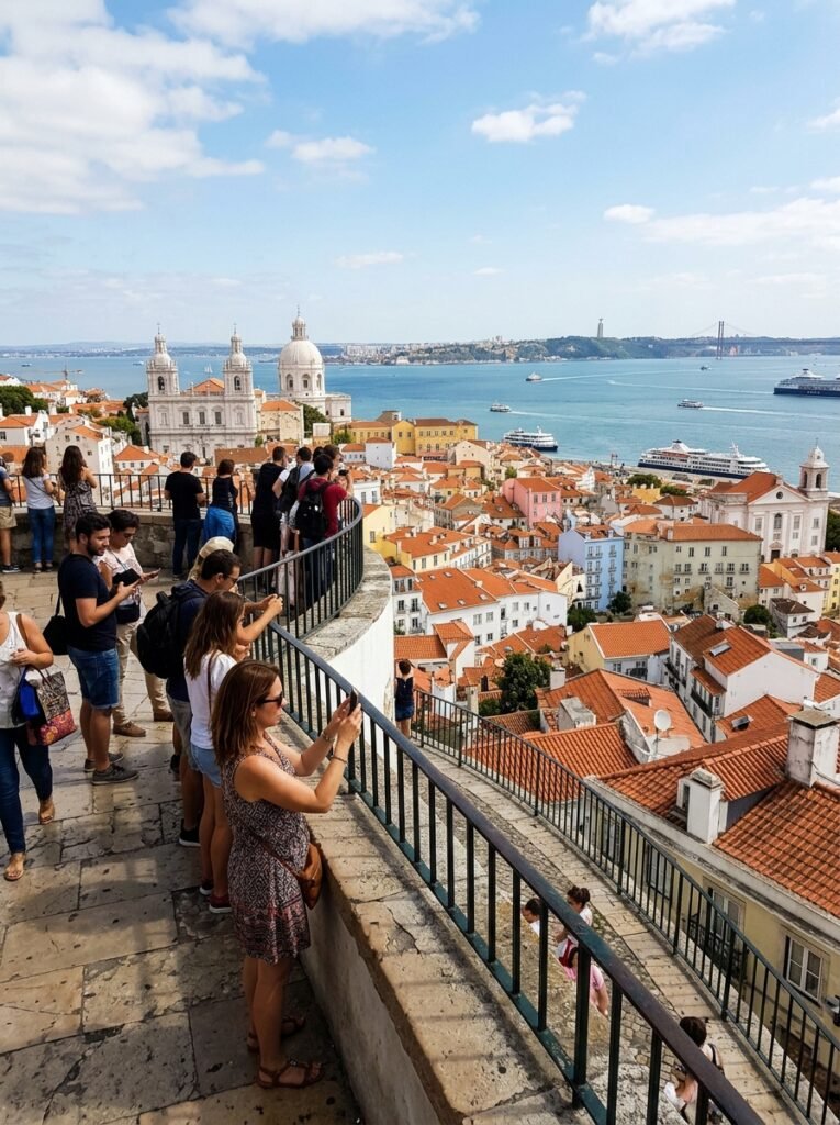
Exact Geographic Coordinates & Street Address
The Miradouro das Portas do Sol serves as a wide public balcony overlooking the oldest parts of the city. The physical location is Largo das Portas do Sol, 1100-411 Lisboa, Portugal. The exact coordinate positioning is 38.7122° N, 9.1303° W.
Step-by-Step Transit Logistics
This platform sits immediately adjacent to the previous lookout, meaning Tram 28 and Bus 737 serve the exact same stop at Largo das Portas do Sol. Walking up from the Cruise Terminal at the waterfront involves a direct but challenging 500-meter climb up the steep stairs of Escadinhas de São Miguel. The stone steps are narrow and heavily worn, requiring solid footwear to navigate safely.
Golden Hour Visual Mechanics
The terrace faces due east, providing an open view of the Tagus River basin and the southern bank. While the sun sets behind the hill, the golden hour light creates a soft glow across the dense maze of the Alfama neighborhood.
Photographers should focus on the changing colors of the river water and the detailed lines of the historic houses below. A medium zoom lens like a 24-70mm is highly effective for isolating individual church towers, such as Santo Estêvão, against the broad water horizon.
Know-Before-You-Go Infrastructure
The square features several large open-air cafés with extensive outdoor seating areas directly on the stone pavement. Public restrooms are located nearby in the underground parking structure for a small fee.
The wide layout offers significantly more standing room than Santa Luzia, though the central viewing rails still experience heavy foot traffic. The open space is a regular transition point for tuk-tuks, meaning traffic noise is common until the twilight period finishes.
Miradouro do Recolhimento (Castelo Neighborhood)
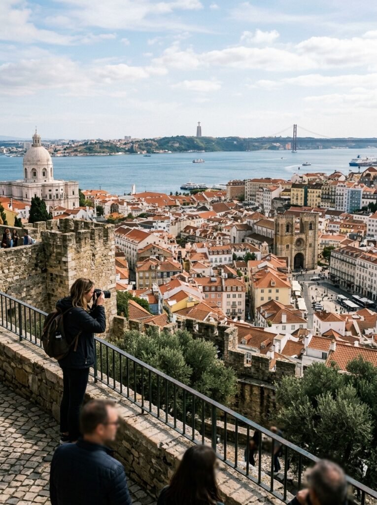
Exact Geographic Coordinates & Street Address
The Miradouro do Recolhimento is a secluded public park positioned on the northern ledge of the Castle hill. The official address is Rua do Recolhimento, 1100-563 Lisboa, Portugal. The geographic alignment for this lookout maps to the coordinates 38.7136° N, 9.1328° W.
Step-by-Step Transit Logistics
Reaching this viewpoint requires entry into the historic citadel walls that surround São Jorge Castle. Visitors can take Bus 737 from Praça da Figueira directly to the castle gates, followed by a flat 200-meter walk along Rua do Recolhimento.
Pedestrians approaching from the Baixa district can utilize the public elevators, starting with the Elevador da Baixa to Rua da Madalena, followed by the Elevador do Castelo up to the citadel entrance. The path is paved with traditional limestone blocks that remain mostly flat but narrow.
Golden Hour Visual Mechanics
This platform faces northeast, offering a unique angle that skips the typical river-facing views found at other city lookouts. The sunset light hits the side of the valley, illuminating the white limestone façade of the National Pantheon and the nearby Church of São Vicente de Fora.
Photographers can capture the deep shadows spreading across the lower residential quarters of Mouraria and Graça. A standard 50mm fixed lens is excellent here for isolating the detailed roof tiles and the geometric patterns of the old apartment blocks.
Know-Before-You-Go Infrastructure
The viewpoint is located inside a small walled community garden that includes a children’s play area and mature olive trees. There are no commercial kiosks, esplanadas, or public restroom facilities located directly within this park space. Because the site is tucked away from the main tourist paths, crowding is minimal even during peak sunset times.
The park has strict operating hours and typically closes its gates to the public at dusk, meaning visitors should verify seasonal closing times before planning an evening visit.
Practical Lisbon Sunset Logistics & Troubleshooting
Understanding the Local Microclimate
Lisbon’s proximity to the Atlantic Ocean introduces significant microclimate shifts that affect evening comfort levels. While afternoon temperatures can be warm, the arrival of the golden hour often coincides with strong northern winds known as the Nortada.
These maritime winds cause temperatures to drop rapidly at high-elevation viewing platforms like Senhora do Monte or Graça. Visitors should bring a medium-weight windbreaker or light jacket to manage the sudden cooling that occurs immediately after the sun drops below the horizon.
Navigating Historic Cobblestones Safely
The traditional limestone and basalt paving known as calçada portuguesa covers almost all pedestrian routes leading to the lookouts. This stone surfaces wear down over decades of foot traffic, becoming exceptionally smooth and polished.
The steep inclines in neighborhoods like Alfama and Mouraria become highly slick, particularly if evening humidity rises or a light rain occurs. Sturdy footwear with rubber soles and deep tread patterns is highly recommended to prevent slipping on the descent from the hills after dark.
Preventing Pickpocketing in High-Congestion Areas
The dense crowds that gather along the observation railings create prime opportunities for opportunistic theft. High-volume transit routes, specifically the historic Tram 28 lines serving Santa Luzia and Portas do Sol, are well-known areas for pickpocketing operations.
Backpacks should be worn on the front of the body, and valuables must be secured in zipped internal pockets rather than loose outer compartments. Maintaining general awareness of immediate surroundings during the final moments of sunset ensures a safe transition into the evening.
Frequently Asked Questions
Do any of the Lisbon miradouros require entry fees or advance ticket bookings?
All the primary public miradouros in Lisbon, including Senhora do Monte, Graça, and Santa Luzia, are completely free to enter and do not require any ticketing or advance reservations. The only exception near these sites is the main archaeological area of São Jorge Castle itself, which requires an independent admission fee. The public viewing terraces outside the castle gates remain open to the general public without charge.
Can taxi or rideshare vehicles drop passengers off directly at the viewing platforms?
Automated traffic restrictions implemented by the municipal government block regular cars, taxis, and rideshare vehicles from entering the narrowest historic streets of Alfama and the Castle district.
Dropping passengers off directly at the railings of Miradouro das Portas do Sol or Miradouro do Recolhimento is generally not possible due to these access barriers. Taxis can typically drop passengers at designated transit hubs like Largo da Graça or Largo do Chiado, leaving a short walk to the edge of the viewpoints.
What are the specific rules regarding taking a tuk-tuk to the sunset viewpoints?
Strict municipal transport regulations restrict tuk-tuk operations inside the historic center of Lisbon. All operating tuk-tuks must be 100% electric, and they are legally banned from entering 337 specific historic streets across Alfama, Baixa, Bairro Alto, and Castelo.
Furthermore, specific high-elevation spots like Miradouro da Senhora do Monte have strict curfews that prohibit tuk-tuk access after 19:00 to reduce noise and traffic for local residents.
Are these high-elevation sunset viewpoints accessible for travelers with limited mobility?
The steep natural topography and historic preservation of Lisbon present significant accessibility challenges for travelers with limited mobility. Lookouts like Miradouro de São Pedro de Alcântara offer relatively flat, wide concrete surfaces that are accessible via public elevators or the Glória Funicular. In contrast, reaching the old town platforms in Alfama or the peak at Senhora do Monte requires negotiating uneven, narrow stone paving, high curbs, and steep staircases that lack modern ramp systems.